
🌪 Introduction: Chantal Takes Center Stage
When it comes to Atlantic storm systems, timing and location are everything. This week, Chantal made a surprise appearance off the Southeast coast of the United States. While the system wasn’t initially expected to intensify, it quickly gained strength over warm ocean waters. As a result, this storm is now under close observation due to its potential effects on nearby coastal areas.

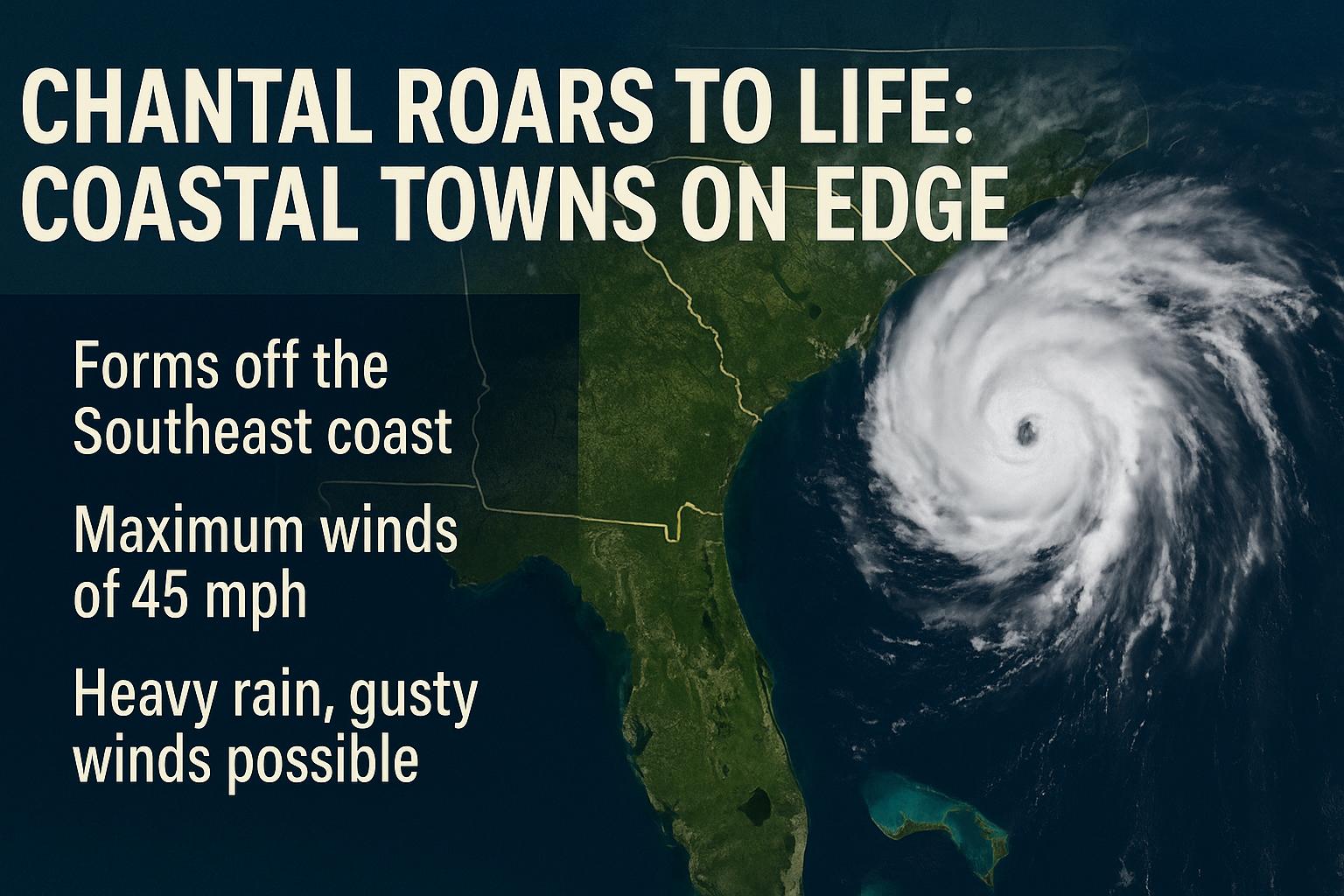
🌊 Where Chantal Formed and Why It Matters
Chantal developed from a low-pressure disturbance in the Atlantic, just southeast of the Carolinas. Within a short span, it organized into a tropical storm. This rapid transformation highlights how unpredictable such systems can be, especially during the height of hurricane season.
Although Chantal may not make direct landfall, its outer bands could still affect coastal weather. Therefore, residents along the shorelines are urged to stay informed and alert.
📍 Chantal’s Current Position and Behaviour
The storm is currently swirling approximately 150 miles off the Southeast U.S. coast. It’s moving northeast, slowly but steadily. Even if it remains offshore, Chantal could still deliver rough seas, gusty winds, and scattered downpours to states like South Carolina, Georgia, and North Carolina.
Importantly, this storm is not classified as a major hurricane. Still, any tropical storm with unpredictable behavior demands respect and awareness.
🌀 What Makes Chantal Unusual
Unlike many named storms that form deeper in the Atlantic, Chantal emerged unusually close to the U.S. mainland. That alone sets it apart. Moreover, it intensified rather quickly, thanks to unusually warm sea surface temperatures.
Such developments are becoming more common in recent years. Consequently, storms like this reflect the evolving patterns of our climate and the need for advanced forecasting systems.
🌧️ What to Expect From This Storm
Here’s what locals and tourists should be prepared for:
- Intermittent rain showers in coastal areas
- Choppy seas and dangerous rip currents
- Brief gusts of wind, possibly between 30–40 mph
- Low-level flooding in poorly drained coastal zones
While this storm is not catastrophic, ignoring its presence would be unwise. Even weak systems can disrupt travel, damage small boats, or impact beach safety.
🔄 How Authorities Are Responding to the Storm
Emergency management teams in affected states have begun issuing updates and safety guidance. Lifeguards are warning swimmers of high surf risks, and ferry services in some areas are experiencing delays. As always, it’s better to prepare early rather than scramble later.
🌍 Chantal and the Bigger Picture
Every storm tells a story. Chantal’s arrival reminds us how quickly the weather can shift and why early detection matters. As part of an already active season, this storm is just one of many potential systems that could emerge in the weeks ahead.
Therefore, experts continue to urge coastal residents to keep their hurricane kits ready, follow trusted weather sources, and never underestimate a named storm—even one that stays offshore.
✅ Conclusion: Staying Safe While the Moves On
Chantal may not break records, but it certainly commands attention. With shifting winds, changing water temperatures, and the unpredictability of nature, Chantal stands as a timely reminder: storm readiness is not just a choice—it’s a necessity.
ALSO READ ABOUT TRUMPS’S BIG BEAUTIFUL BILL